
Why Use Unmanned Aerial Vehicles?

Matrice 600 Pro

UAVs have proven to be powerful new tools for archaeologists and resource managers. Aerial photographs are used to accurately map complex sites and landscapes, allow you to identify features visible from the air, and can be used to document large-scale excavations or create baseline environmental and site data for long-term monitoring. Equipped with multispectral cameras, they help you locate subsurface cultural features and quickly and easily map vegetation. Employing LiDAR units, they map subtle features often not visible on the ground and locate things hidden by thick vegetation in conventional aerial photographs.

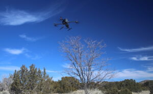
UAVs offer key advantages over traditional archaeological aerial imaging particularly in their ability to cover large areas at a fixed altitude and speed under a wide range of wind and weather conditions. Their flexibility and speed offer you significant potential cost savings in person hours and equipment fees relative to conventional survey and mapping techniques and other forms of aerial photography.

Why Use Aspen?

Aspen CRM Solutions delivers highly accurate topographical data to surveyors in the cultural resource, engineering, mining, and agricultural communities. We combine high resolution aerial photography with precision GPS data to generate georectified orthophoto maps, digital elevation models, and 3D point clouds. We utilize rotary and fixed wing craft and provide certified photogrammetrists and UAV pilots.

Our Aerial Mapping Services


Orthomosaic Images

Our orthophoto collection services are capable of generating resolutions of less than 2 cm per pixel, with accuracies sufficient for 1-foot contours when combined with ground control reference points.

Outputs

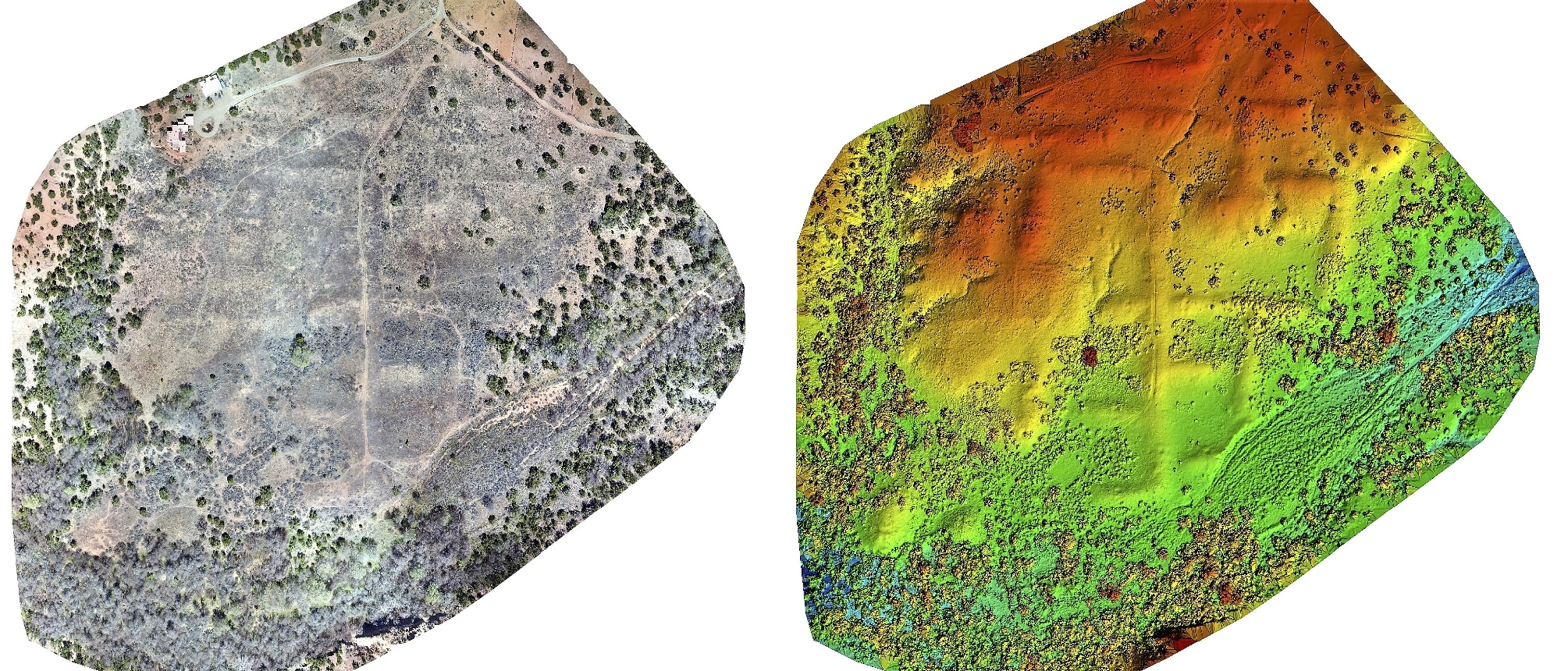
(Left) Orthomosaic of a medium sized pueblo (Right) Digital surface model of a medium sized pueblo

Digital Surface & Terrain Modeling

  • We produce CAD and GIS compatible digital elevation, surface, and terrain models useful for cultural resource managers, designers, engineers, and land managers. Visualize archaeological site conditions and drainage plans, survey quarries and landfills, or conduct a flood risk assessment.


Survey Grade Topographic Lines 

1 foot contour lines

  • Due to the nature of creating accurate and precise Orthomosaics with sub-centimeter accuracy, topographic lines with intervals of 10 feet, 5 feet, 1 foot, and even smaller are easily possible. Our topographic lines can take into account objects such as vegetation and buildings or remove these objects so that only the true terrain is taken into consideration.


Reflectance Modeling 

  • We cover a large range of spectra needs, whether you are interested in multi-spectral NDVI analysis of cropland or forests, thermal infrared for biological or soil conditions, hyper-spectral sensors for specific elements of interest, or LiDAR for unparalleled landscape recreation.

3D Models

3D model of a Large Pueblo

Following the collection of orthophotos, the images are broken into millions of data packets tied to each pixel in each photo. These packets each have unique elevation and location data and once related to one another allow for the creation of  models where highly precise measurements can be performed.

Applications 

Stockpile + Volumetric Analysis 

  • UAV-based surveying enables precise measurements and stockpile volume calculations. Volumes can be generated with overall accuracies averaging 97% or higher.


Structure and Object modeling

  • We can provide accurate measurements for structures or objects recreating their physical and visual characteristics. Whether for recreation of a specific scene, or a desire to have a data driven model for analysis the options are limitless.

Our Equipment:

Inspire 1 Pro

  • Lightweight 7.5 lb. UAV operating on 4 rotors

    DJI Inspire 1 Pro

  • 20-minute flight time
  • Intelligent aerial controls allow UAV to maintain constant altitudes above changing terrain.
  • Can be both manually operated or preprogramed to do autonomous flight.
  • Can be flown in winds up to 22 mph.

Equipped with a Zenmuse X-5 Camera

  • 16 MP images and 4k video designed specifically for aerial imaging
  • Micro Four Thirds Sensor allowing for image ISO ranges from 100-25600
  • 3 Axis Gimbal for total camera stability and image steadiness as well as 360 degree imaging.

Matrice 600 Pro

  • Heavy hitting 25 lb. UAV operating on 6 rotors

    DJI Matrice 600 Pro

  • 20-minute flight time with full payload
  • Intelligent aerial controls allow UAV to maintain constant altitudes above changing terrain.
  • Can be both manually operated or preprogramed to perform an autonomous flight.
  • Can be flown in winds up to 35 mph.
  • Can fly as fast as 40 mph.

Equipped with a Ronin MX Gimbal

  • Cinematic grade filming gimbal with smooth track capabilities and silent motors.
  • Allows for the attachment of high-grade cameras for imagery.
  • 360-degree imaging as well as 135 degree tilt allowing for an unprecedented aerial perspective.

Equipped with a Sony a7riii camera

  • 42.4 MP camera
  • 4k video 10 fps
  • ISO range up to 32000
  • Steady shot axis control

FireFly6 Pro

  • 9.9 lb. lightweight UAV operating on 3 transformation rotors
  • 50-59 minute flight time with payload

    BirdsEyeView FireFly 6 Pro

  • Under optimal conditions, covers up to 600 acres in a single deployment
  • Capture the data you need using a wide range of advanced sensor payloads
  • Speeds up to 35-40 mph

Equipped with Sony RX1R camera

  • 42.4 MP camera
  • 4k video
  • ISO ranges up to 102400
  • Steady shot axis control
If you are logged in, you will see client services here. If you are a client and wish to have access to our online services, including file sharing, please contact us.